Travels of the Jabberwocky (If you want to see our position then go to : www.shiptrak.org and enter radio call sign KB9RPI.) Copyright 2006 to 2012 All Rights Reserved

Thursday, November 30, 2006

Wednesday, November 29, 2006 - Cocoa, FL

We finally arrived at our destination at about 10:30 am this morning completing the last 15 miles of this leg of our venture. We had to pass through a lock at Port Canaveral that protects a canal that connects the port to the Banana River and on through to the Indian River. The lock was under maintenance and when we called the lockmaster at 7:00 am for a time of passage he suggested that if we could get by 8 to pass through the Route 401 lift bridges he could get us through at low tide without disrupting his work crew. We immediately agreed, quick munched down breakfast and left the dock to stand by the bridge for its opening after the rush hour.

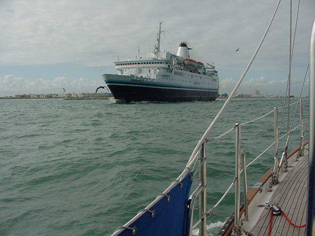
After an hour transit west through the Cape Barge Canal and through one last lift bridge for which we just made the 9:00 am opening time we entered the Indian River and were greeted by a down pour of showers that reduced visibility to a quarter of a mile at times. The traffic of boats heading south on the Indian River ICW was amazing and we had to get into the parade of boats. Everyone was running at 3 to 4 miles per hour because of the reduced visibility and narrow channel.

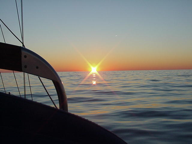
The rain finally abated as we approached the bridge near the Cocoa Village Marina (http://www.cocoavillagemarina.com/) and we were able to enter the marinas channel in clear skies and good visibility.

We will spend this evening with Joyce's mom who lives in Titusville about 15 miles from here. This will be the first time we have been off Jabberwocky since the middle of July!

Tuesday, November 28, 2006

Tuesday, November 28, 2006 Port Canaveral, FL

We arrived at Port Canaveral (Cape Kennedy) at noon today after a bumpy trip over night from Mayport. Winds were 15 to 20 and the seas this morning were 5 to 7 although we are convinced the occasional wave was a bit bigger.

As we were coming into the channel we were met by the local boat, a cruise ship and an oil barge.


As we were approaching the harbor entrance we could see the NASA rocket launch towers in the distance.


Tomorrow we are off to Cocoa FL on the Indian River about 15 miles from here where we will keep our boat during December.

Sunday, November 26, 2006

Sunday, November 26,2006 Mayport, FL

Hurray, Hurray - We have finally made it to the Sunshine State!! But we are wondering why it is still 50 to 60 degrees and we have to wear the 5 to 7 layers of clothes that we had to in Northern Michigan when we are sailing here.

We just completed our 220 nautical mile two day journey from Georgetown, SC to Mayport, FL. Mayport is at the entrance of the St. Johns River and about 15 miles east of Jacksonville. We will set off to Cape Kennedy tomorrow mid-day for a Tuesday morning arrival.

We arrived off the river entrance so early this morning that we had to stand too off the channel for a couple of hours until sunrise. We were dodging several trawlers and 7 foot seas until the sun came up at 7:00 am.

We thought that we would have a calm trip down the South Carolina and Georgia Atlantic coasts but we received a small craft weather advisory forecast yesterday at noon and we had to continue as there were no ports that we could enter on the coast. We had a North East wind at 15 to 20 knots all night with 5 to 7 foot seas and were glad when we finally found ourselves inside the the St Johns River Channel.

The weather has been cold and clear and the scene at sunset reminds us of going to a planetarium.


There is a major US Navy base at Mayport. Joyce's brother Terry was based here in the late 60's and at that time was it the home of the 6th Fleet that served in the Mediterranean Sea. It seems as we travel that we frequently touch connections to our family's history.


We are heading out to Cape Kennedy tomorrow where Coco is our final destination until after Christmas.

Friday, November 24, 2006

Friday, November 24, 2006 - Georgetown, SC

The sun is out and the skies are clear and we are getting ready to leave late this morning for our two day trek to the St. John River entrance near Jacksonville, FL. We will be traveling about 250 miles along the coast and will be providing Shiptrak updates along the way.


We are off the local bakery to pick up some fresh bread and sweet rolls for breakfast on the trip. This bakery is so popular that everytime we have gone there in early afternoon everything is gone and Wednesday they were baking dozens of pies for their customers turkey day dinner.

Here are a few more pictures of sights around Georgetown as we arrived last Saturday so it has been a week waiting out weather. Because of the cultivation of rice and indigo in this region in the 1800's the plantation owners here were actually the richest people in the United States. Many even had homes in Newport, RI. The region's importance declined after the Civil War due to it's dependence on slavery to grow the crops. 85 percent of the people here during the heyday were slaves. To learn more about the town visit their website: http://www.seaportgeorgetown.com/index.shtml


This is the Kaminski house. It was built in the 1700's and the last owner donated it to the town to preserve it's historical value. We had a great guide that spent over an hour with us discussing the history, furniture, paintings and various restorations that have taken place.


An old wooden trawler moored by the Kaminski house. Extremely well maintained.


The town has many small well designed parks tucked away between various buildings.

Thursday, November 23, 2006

Thanksgiving - November 23, 2006 - Georgetown, SC


Happy Thanksgiving
from
Gordon and Joyce
At the Lands End Restaurant after a big Thanksgiving buffet.

Tuesday, November 21, 2006

Tuesday, November 21, 2006

We came south to get warm and this morning the area had the earliest snow on record and the day time high temperature is 40. We are glad we are in a protected harbor with the storm that is brewing on the ocean. The weather forecasters are calling it a Nor'Easter in the South and they are really excited about it. This was the harbor at daybreak this morning.

The bad weather should move out by Thanksgiving and we should be able to continue on Friday. Our plan is to have a 2 day run to Jacksonville, FL, layover for a day and they have an overnight run to Cape Kennedy, which is our destination.

This sign freeked us out when we saw it. We didn't think alligators lived this far north, but apparently they do. We continue to need to wear multiple layers of clothing-Joyce has her winter jacket and sweatsuit on-we thought we would be escaping the cold-but it is 38-40 degrees with wind chills reducing the temperture further.


This is the main street of Georgetown. The clock tower is on a building built in the early 1800's that is now a Museum. The old section of town has some incredible homes that were built in the 1700's and 1800's and it has been fun walking around these areas.

Monday, November 20, 2006

Monday, November 20, 2006

We are currently at dock in Georgetown, S.C. on the Winyah River , south of Cape Fear. We hoped to make Charleston, SC , 60 miles south, but we did not want to enter Charleston in the dark and this was the safest harbor to approach from the sea. This was a 28 hour run. We left Beaufort, N.C at 7 a.m. on Saturday the 18th and arrived here at 11 a.m. Sunday the 19th. It was a beautiful run with 10-15 knot winds and the night time sky was full of stars including a meteor shower. On our entrance to the harbor we were greeted with the sight of many dolphins diving for food as they appeared to be following commercial fishing boats trawling their nets off the harbor inlet. Unfortunately we are going to be in Georgetown for a few days. There is a coastal storm (a southeaster) which will bring stiff winds (50-60 knots) on the coast which is part of a slow moving low system. So we will see if we can make a nautical Thanksgiving dinner in our cozy cabin and move out of here on Friday, depending on sea conditions.


We were one of many boats leaving Beaufort on Saturday morning.


Red sails catching the sea breezes.


We shared the sea with the Navy. We passed several naval vessels on maneuvers. Gordon talked to this vessel to be sure we observing the security zone around the boat. Later we saw a large aircraft carrier in the distance and with binoculars Gordon saw the airplanes flying off the deck.


Georgetown lighthouse on Sunday morning.

Friday, November 17, 2006

Friday, November 17, 2006

Yesterday we stayed in the Beaufort Harbor to wait out the severe weather. After having the boat lines secured to the floating docks we watched the rain and wind storm approach in the afternoon. While in our cabin, we watched the anemometer as the wind increased to 48 knots!. The wind and rain was hollowing across our bimini. We could not even see across the harbor because of the sheets of driving rain. Even though we were surrounded by 50 foot plus yachts which provided some protection against the wind, our boat actually healed in the driving wind. The storm was very fast and within an hour it had past and our decks started drying up in the cool air. Gordon was watching the storm on his computer and predicted it would be a quick storm as indicated on the weather chart. We are staying over today and heading out to sea tomorrow for our next favorable weather window. We were planning to go to Charleston, SC but most likely we will make a run to Georgetown which is 70 miles north of Charleston. This will be a 28 hour run and we can approach the harbor in daylight. The distance to Charleston is too far to approach the harbor in daylight. Since we are so close to the Gulf Stream, we are watching the weather window closely. For our non sailing friends, the winds against the Gulf Stream current can produce huge uncomfortable confused seas. We are in a harbor with boats from all over the world including London and Australia! We captured some of the sites of the town below.

Some of the historic sites include this cemetery which includes the burial ground of confederate soldiers from the Civil War.


This house was close to a historical preservation site. It has a lovely Queen Ann's Lace frame around the porch.


Jabberwocky in Beaufort Town Dock. By the afternoon this dock was full of boats seeking safe refuge from the storm.

Wednesday, November 15, 2006

Wednesday, November 15, 2006

We are out of the intercoastal waterway and are docked at the Town Dock of Beaufort, N.C. We can look out and see the Atlantic Ocean once again. The last two days on the intercoastal waterway we had the pleasure of having dolphins swimming around the boat! They came very close to the starboard side and starled me when they came up and then nosedived under the bow wave. We tried to take a picture of them but they were too quick diving and playing in the waves.

Beaufort is a picturesque sea side town with an interesting maritime museum which we visited this afternoon. The museum (http://www.ah.dcr.state.nc.us/sections/maritime/) includes a unique world wide shell collection, boat building displays of local fishing boats, and pieces from the wreck of Blackbeard's flag ship Queen Ann's Revenge. We arrived inBeaufort this morning and will be here a few days as there is a rain storm with 30-35 knot winds and gusts to 40 passing through the region on Thursday. The docks are filling up with boats as everyone is looking for a save refuge.

This was the antique boat that we had in yesterday's blog passing us on one of the many bays we had to traverse.


Fishing fleet in the intercoastal canal. You can see the tugboat and barge which just past us going north under the bridge.


Several of the lovely homes along the water front in Beaufort. Many of the homes were built in the late 1700's or early 1800's.

Monday, November 13, 2006

Monday, November 13, 2006

We are celebrating Gordon Lee's birthday today at this lovely southern Inn located at the Marina we have been staying at for the past 2 days. We delayed our trip out today because of low water levels at the dock. There were 30-35 knot winds yesterday that literally blew the water out of the bay and the water levels have been slowly rising today. Our plan is to head out early tomorrow for Beaufort, NC which will put us back on the Atlantic coast for our next adventure on the ocean sometime on the week-end if weather permits. A low front will be heading this way mid week so we will have to wait for a weather window.

River Forest Marina Inn in Belhaven N.C. Where we will be having dinner tonight.


This is a lovely classic wooden yacht from Newport Rhode Island which came into the harbor today.


They don't make wooden yachts like this anymore so we could not resist taking a picture to share with all of our family and friends.

Sunday, November 12, 2006

Sunday, November 12, 2006

In Belhaven, NC and have lost track of time and Internet access in this area. We are about 80 miles north of Beaufort, NC and plan to be there tomorrow. Fortunately the marina we are at has wireless access as GSM for my laptop and the cell phone are not available here. It is strange to not have phone access. We are staying here for the day as a cold front is coming through and these various rivers and sounds get stirred up a bit in the weather.


This was on November 10th on our way to the Alligator River just leaving Great Bridge. We had to get going before sunrise to catch an early bridge opening before the closed for the morning rush hour between 6:30 and 8:30.


Fall continues to follow us south.


The causeway where we stopped at Alligator River Bridge.


The above causeway has a swing bridge and the center rotates to let us through.


This is typical of the scenery along the banks of the canals connecting the various rivers and sounds in this area. This was along the Alligator and Pungo River Canal.

Thursday, November 09, 2006

Thursday, November 9, 2006

We departed Hampton, VA this morning for the entrance of the Intercoastal Waterway about 13 miles south at the city of Norfolk, VA. This trawler followed us out of the channel .


This is a journey up the Elizabeth River past the Norfolk Naval Yard and many other Navy Yards almost every where you look. You wonder how they get things like aircraft carries down this river and into maintance docks.


The Norfolk waterfront.


The naval yards.


We ended the day tied up to a public dock at Great Bridge, VA about 12 miles south of Norfolk. While it sounds like we did not make much progress today, this was a tough section of the ICW where we had a number of draw bridges that only open on the hour or half hour and one lock to traverse.

It was incredibly WARM today in the mid 70's and we could finally shead most of our "layers" of clothing for a change.


Tuesday, November 07, 2006

Tuesday, November 7, 2006

Currently staying at Hampton, VA. The town has a lovely harbor area. We were here about this time last year for a emergency medical training course for off shore sailors and enjoyed our stay.


The Carib1500 leaves from here and the fleet of 71 boats is still here due to weather. Usually someone from our US Sail and Power Squadron is crew on one of the boats. We discovered that this year it is our friend Terry Hartl who is crew on Pied-A-Mer a Hans Christian 43. We went to the marina hosting the event and tracked down Terry this morning and had a nice visit and thanks to the captain, Paul, were able to go on board for a few minutes. The are leaving tomorrow morning and the last minute preparation is underway and the excitment level high.


Several of the local Coast Guard patrol boats come into the harbor for a break from patrol. They are concerned with the security of the naval base here and they are heavily armed as can be seen in this photo when they came by this morning.

Monday, November 06, 2006

Monday, November 6, 2006

With a long sail behind us we arrived at Hampton, VA at 11:00 am this morning after a 26 hour run down the coast of Delaware. Hampton is at a point in Chesapeake Bay that is called Hampton Roads as several different rivers converge at this location. To our south is Norfolk, VA and the start of the Intercoastal Waterway (ICW).

Passing Ocean City, Delaware at sunset. These coastal resorts are amazing for their highrise condo's.


Sunset on the Atlantic Ocean . An enjoyable part of the journey is watching sunrise and sunset with unobstructive views while sailing on the open ocean.


Passing one of several naval ships while heading up the Cheasapeake Bay .


A container ship approaching us in the channel. We had to quickly turn around and cross her wake as she passed.


Here she is after she passes.


We are expecting some rain tomorrow and we are going to layover here. Wednesday we will set out for the ICW and head for Morehead City, NC to bypass Cape Hatteras and then head south down the coast weather permitting.

Saturday, November 04, 2006

Saturday Nov 4 update

We spent the day in Cape May, catching up on the sleep we missed last nite. In the afternoon we walked around town and watched the fishing fleets bring in their catch of the day. Since we sailed only a few miles off the New Jersey shoreline we captured some pictures along the way.

Sunset at Sandy Hook, N.J.


This sail boat followed us along the coast until late in the nite.


We sailed passed Atlantic City at 2 a.m and the skyline could be seen for miles.


Cape May New Jersey a land of fishing fleets.